
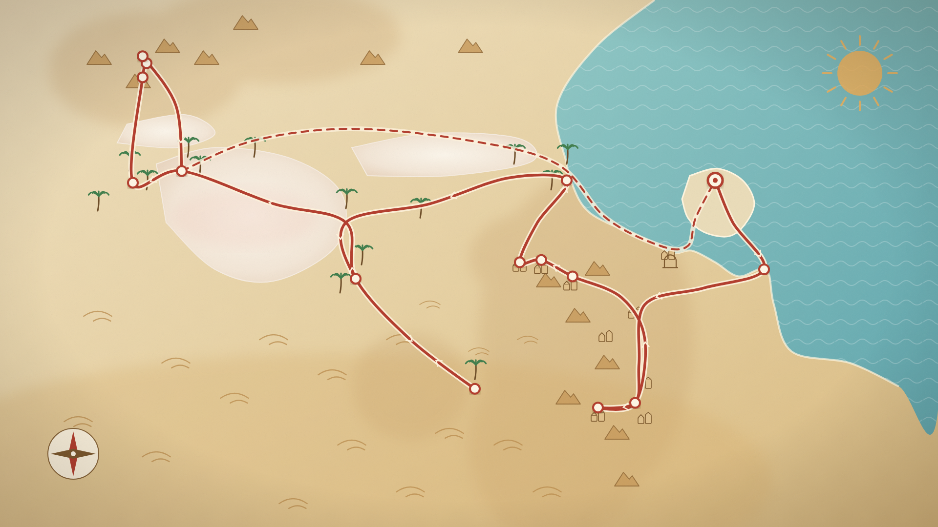
Somewhere past Medenine the olive groves give out, the road starts to climb, and the first ksar appears on a ridge like something left behind by a civilisation that packed up and moved on. It is the moment most people’s southern Tunisia road trip begins in earnest, and it comes about ninety minutes after collecting the keys at Djerba airport. Everything that follows, the cliff villages, the troglodyte houses, the dunes, the salt lake and the mountain oases, sits inside a loop of roughly 1,100 kilometres that a standard rental car can drive in a week.
When we posted a map of this loop on Facebook, a few thousand people had opinions about it. Most were additions, and the best of them are now in this guide, with credit where it’s due at the end.
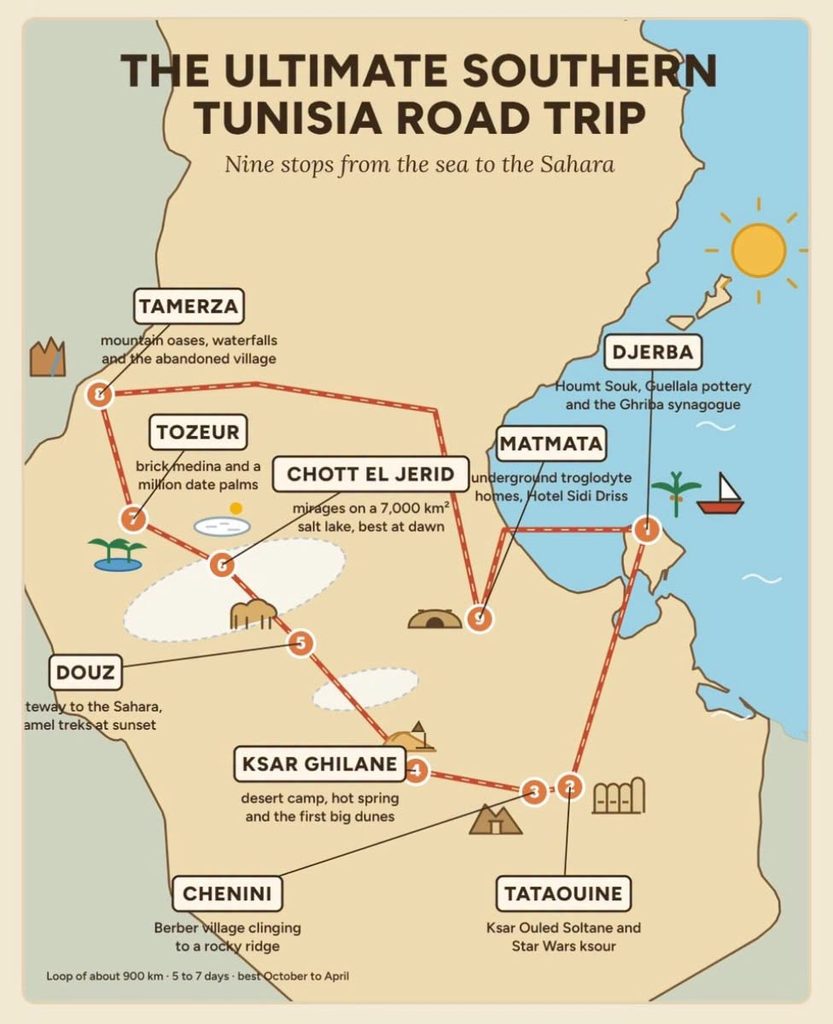
This is a different trip from our national road-trip loop, which starts in Tunis and samples the whole country. This one stays south of Gabès the entire time, which means less driving, more desert, and no day spent on a motorway.
The Short Answer
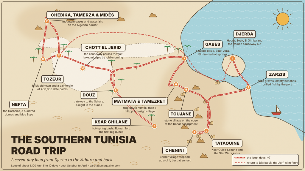
Fly into Djerba, rent a car there, and drive the loop clockwise: Djerba → Zarzis → Tataouine and Chenini → Toujane → Matmata and Tamezret → Gabès → Douz → Ksar Ghilane → Tozeur and Nefta → the mountain oases → back to Djerba (or drop the car in Tozeur and fly or take the train north).
Seven days is comfortable, five is possible if you cut Zarzis and Ksar Ghilane, and ten lets you sleep in the dunes twice. Go between October and April; the loop is punishing in July and August. Every stop below is on tarmac. The only places that need a 4×4 are the dune sets near Nefta, which you do with a local driver anyway.
Before You Set Off
Rent at Djerba airport rather than in Houmt Souk; the desks are all there, the rates are among the lowest in the Mediterranean, and you avoid driving the island’s lanes with a car you don’t know yet. Our car rental guide covers the deposit, the excess and the walk-around. Ask about a one-way drop in Tozeur if you’d rather not drive back; most agencies allow it for a fee.
Three rules make the south easy. Finish each driving day before dusk, because unlit rural roads with stray animals are the one real hazard. Fill the tank at half, because stations thin out between Tataouine and Douz and again on the Ksar Ghilane road. And download offline maps and buy a local SIM at the airport, because coverage drops in the hills; our SIM guide says which network holds up best down here. Police checkpoints are routine and friendly; keep your passport and rental papers in the door pocket. The ten road habits to expect from other drivers are worth reading on the plane, and make sure your travel insurance covers driving.
Day 1 – Djerba → Zarzis · 60 km
Give the morning to Djerba: the souk at Houmt Souk, the whitewashed mosques, the El Ghriba synagogue if you haven’t seen it. Then cross the Roman causeway at El Kantara, seven kilometres of road that Carthage’s engineers laid across the lagoon, and follow the coast to Zarzis, a town of olive groves and empty beaches that most visitors skip. That is the point. Swim, eat grilled fish by the port, and sleep early; tomorrow is the first real driving day.
If you’d rather leave the island by the Jorf–Ajim ferry, the detour pays for itself: the Roman port of Gigthis, at Boughrara, is ten minutes from the ferry landing, a forum, temples and a basilica on the edge of a lagoon, almost always empty, free to walk around. From there it’s forty minutes to Medenine and you can skip Zarzis and sleep in Tataouine, which gets you to the ksour at dawn.
Day 2 – Zarzis → Tataouine → Chenini · 150 km
Inland through Medenine, where the ksar in the town centre is a taste of what’s coming, to Tataouine. The town itself is a market and a base; the reason to be here is the ring of fortified granaries around it. Ksar Ouled Soltane, twenty minutes southeast, is the finest, four storeys of mud-brick storage cells (ghorfas) stacked around two courtyards, and the one George Lucas used for the slave quarters of Mos Espa. Ksar Hadada, north of town, is the other film location and now a hotel of sorts.
Save the late afternoon for Chenini, eighteen kilometres west: a Berber village stepped up a cliff below a white mosque, still inhabited, still farmed, and at its best when the sun drops behind the ridge and the rock turns copper. Guermessa and Douiret, two more cliff villages nearby, are emptier and, to some tastes, better.
Ghomrassen, twenty minutes north of Tataouine, is the town the ksour villages moved down to, with a cave-mosque and the Ksar Ezzahra above it; readers from the region insist on it, and they’re right. On the way down from Medenine, the ksour of the Beni Kheddache plateau (Ksar Jouamaa, Ksar Hallouf) are the quietest in the south. Sleep in Tataouine, or in one of the restored houses in Chenini if you want the stars.
Day 3 – Tataouine → Toujane → Matmata → Tamezret · 140 km
This is the day the Facebook post was really about. Head back north to Medenine and take the mountain road west toward Matmata through Toujane, a stone village hanging off the edge of the Dahar escarpment with views across the plain to the sea. There is no guide to it on this site yet because there is nothing to do there except arrive, drink tea with whoever waves you over, buy a jar of the wild-thyme honey the village is known for, and leave slowly. The road beyond it climbs and twists through a landscape of terraced wadis and ruined ksour; drive it in daylight and allow twice the time the map suggests.
Matmata is where the Amazigh dug their homes into the ground: a central pit open to the sky, with rooms hollowed out of the walls, cool in August and warm in January. Several hundred people still live this way. The Hotel Sidi Driss, which was Luke Skywalker’s childhood home, serves lunch in the set. For the night, go ten kilometres west to Tamezret, a stone Amazigh village on a hilltop with a tiny museum of Berber life and, in Dar Ayed, the guesthouse more readers recommended than any other address on this loop. The Star Wars locations guide has the full list for anyone counting.
Day 4 – Tamezret → Gabès → Douz · 190 km
Down from the hills to Gabès, the only seaside oasis in the Mediterranean. Give it two hours: the spice and henna stalls of Souk Jara, then the palmeraie at Chenini-Gabès, where the oasis meets the sea. On the road west, El Hamma has Roman-era hot springs still used as public baths, a twenty-minute stop before the long straight through Kebili, the town whose own oasis and ksar are worth a coffee, to Douz, the gateway of the Sahara, where the tarmac ends and the Grand Erg Oriental begins.
Arrive by mid-afternoon. The dunes start at the edge of town, and the choice is between a sunset camel trek of an hour or two and a night in a desert camp an hour into the erg. Take the camp if you can; the silence and the stars are what people come for. If you are here in late December, the Sahara Festival fills the town with camel races and poets, and rooms go months ahead.
Day 5 – Douz → Ksar Ghilane · 125 km
The pipeline road south from Douz is tarmac now, which means the oasis at Ksar Ghilane is no longer a 4×4-only destination, and it is the deepest into the Sahara you can drive yourself in Tunisia. Palms, a hot spring you can swim in, a ruined Roman fort on a dune twenty minutes’ walk away, and a ring of camps from basic to very comfortable. Do nothing. Swim at dusk, walk to the fort at dawn.
If a second desert night is one too many, skip Ksar Ghilane and drive from Douz straight to Tozeur on Day 5, which turns this into a six-day loop.
Day 6 – Ksar Ghilane → Chott el Jerid → Tozeur → Nefta · 250 km
Back up to Douz and Kebili, then the drive you have seen in every photo of the south: the causeway across Chott el Jerid, a salt lake the size of a small country, white and pink and shimmering with mirages by mid-morning. Stop often; it costs nothing. Tozeur is on the far side: the brick-patterned old town of Ouled el-Hadef, a palmeraie of 400,000 trees, and the Deglet Nour dates that are harvested from late October, which is one more argument for autumn.
In the late afternoon, twenty-five minutes west, Nefta: the Corbeille, a sunken basket of palms fed by springs, a hundred domed shrines, and, out in the dunes beyond it, the Mos Espa set, which you reach by local 4×4 for the last light. More readers named Nefta than any other stop on this loop; one wrote that without it there is no adventure and no emotion, which is about right. Sleep in Tozeur; our where to stay guide has the old-town dars and the desert camps.
Day 7 – The Mountain Oases, then Home · 160 km local, then 370 km or a flight
Leave early for the three mountain oases on the Algerian border: Chebika, Tamerza and Midès, a waterfall in a gorge, an abandoned village above a canyon, and a palm-filled crack in the mountains that The English Patient used as a backdrop. The loop from Tozeur is tarmac and takes a morning.
If you have an extra half-day, the detour north to Metlaoui is the one readers asked about most. The Lézard Rouge, the 1910s Bey’s train that runs through the Selja gorges, returned to the rails in May 2025 after more than eight years out of service, restored in the SNCFT workshops in Tunis. At the time of writing it does not run on a published timetable; ask at your Tozeur hotel or the Metlaoui station the day before, and treat it as a bonus rather than a plan.
Then decide. Drop the car in Tozeur and fly to Tunis, or take the overnight train that resumed service in 2025 (our Tunis to Tozeur guide has the timetable and the honest verdict on it). Or drive back to Djerba, about 370 kilometres via Gabès and the Jorf–Ajim ferry, which is four and a half hours and gets you to the beach by sunset for a last night on the island.
How to Stretch or Shrink It
With five days: Djerba → Tataouine and Chenini → Matmata → Douz → Tozeur, drop the car, fly out; one reader did exactly that in January, five days and four nights, and called it the best thing he’d done in Tunisia. With ten: two nights in the dunes, a day at Guermessa and Douiret, the Beni Kheddache ksour, the Lézard Rouge, and a last two days on a Djerba beach, the loop our 10-day itinerary builds on. Another reader recommends seventeen days, and having tried, we don’t think she’s wrong. Without a car: every leg has a louage equivalent except Ksar Ghilane and the mountain oases, which you book as day trips from Djerba or from Tozeur.
When to Go
October to April. Autumn gives you the date harvest and warm days; December and January are the clearest skies and the coldest nights in the dunes (bring a real jacket for the camp); March and April bring wildflowers to the Dahar and the last comfortable desert days. May is already hot. July and August are for people who have no choice; the best time to visit guide has the month-by-month detail.
What Readers Would Add
The loop above is one week’s worth of the south, and the people who know it best were quick to point out what’s left over. For a second trip, or a longer first one: the track from Zraoua to Bazma through the old Amazigh villages above Gabès; El Guettar and the oasis country east of Gafsa; the Selja gorges by train; Rjim Maâtoug, the planted oasis in the far southwest beyond Douz; the El Bibane lagoon between Zarzis and the Libyan border, where the fish barrages are a thousand years old; and the long way back from Tataouine to Djerba via Ben Gardane. One reader, who did the whole loop in 2008 and is going back in 2027 with his own Jeep, plans to add the north. That’s the usual outcome.
Frequently Asked Questions
Yes. Every stop above is on tarmac, including Ksar Ghilane since the pipeline road was sealed. Only the dune sets near Nefta need a 4×4, and you hire one with a driver in Tozeur.
Five at a minimum, seven comfortably, ten if you want two desert nights and time on Djerba’s beaches.
No, but Djerba has far more flights and cheaper cars. Tozeur works if you’re coming from Tunis by train, in which case drive the loop anticlockwise. From Tunis itself, the national loop is built for that.
The roads are quiet and the people are kind; the risks are night driving, animals on the road and running low on fuel. Checkpoints are routine. The Libyan border zone south of Tataouine is restricted and not on this route; see Is Tunisia Safe? for the wider picture.
Yes, since May 2025, after an eight-year stop, but without a reliable public timetable. Check locally in Tozeur or Metlaoui the day before; don’t build the trip around it.
Both. Djerba, Tozeur, Chott el Jerid and Tamerza are the French-derived spellings used on road signs and in this guide; Jerba, Tamaghza and Chott Jerid are closer to how Tunisians say them.
With thanks to the readers of the Carthage Magazine Facebook page, whose additions shaped this guide.
From the Carthage Magazine Bookshelf
Three ebooks for the glovebox, one of which covers every ksar on this road.
- All About Tunisia — the definitive English-language traveler’s guide. 572 pages, 27 chapters, all nine regions, every UNESCO inscription, five thematic trails — and the practical answers (visa, currency, transport, etiquette) most travelers wish they’d had on the plane. $24.99 · PDF & EPUB.
- Speak Like a Local — 200+ Tunisian Arabic phrases with native audio recorded in Tunis. The phrases for the taxi, the souk, the café, and the dinner table. $14.99 · PDF, EPUB, MP3.
- The Authentic Tunisian Cookbook — sixty traditional recipes from the heart of North Africa. For when you get home and find yourself missing the food. $9.99 · PDF & EPUB.
All three available as a bundle for $39.99 — guide, language, and food, delivered together.
